


Hurricane Rosa is currently a Category 4 Cyclone, with wind speeds reaching 120+mph, and continues to grow in strength. Weather forecasts predict it will make landfall sometime on Monday or Tuesday in Baja California.
So why aren’t people sounding the alarm?
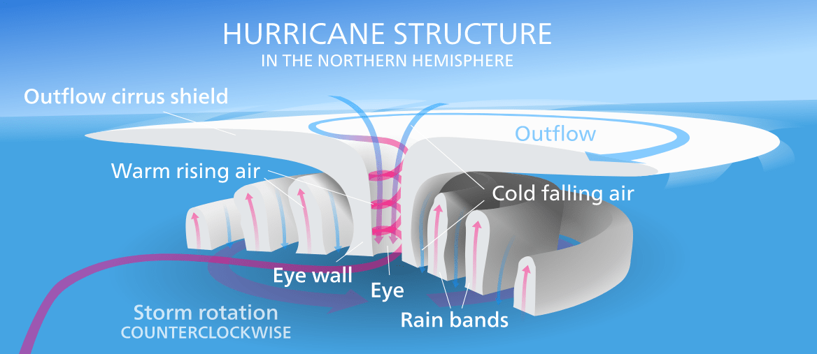
Hurricanes require warm water to retain and increase their strength. The warm waters in turn allow warm, humid air to rise and result in strong winds and storms.
The water closer to the California coast is cold, which means Hurricane Rosa will rapidly lose its strength. By the time Hurricane Rosa makes landfall, it will only be a tropical storm.
Here in Southern California, the result of Hurricane Rosa will be half an inch of rain at most and 6-10ft waves at the beach. Expect delays on your commute Tuesday morning as commutors deal with slick roads from the rain. Areas affected by wild fires this year will be on alert for debris flows.
As Hurricane Rosa continues its course inland, some parts of the Southwest may experience 1-3 inches of rain with several states including Arizona and Nevada preparing for flooding.
Here is a preliminary storm total estimate from Monday afternoon through early Wednesday morning. Highest amounts across L.A. County with 1/2 to 1 inch. Bulk of the rain expected Tuesday. These amounts could change based on the track of remnants of #HurricaneRosa #cawx #LArain pic.twitter.com/dInpC3AeZk
— NWS Los Angeles (@NWSLosAngeles) September 28, 2018


